


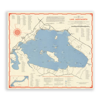
sku: 0897
Lake Winnepesaukee Navigation Chart Reproduction
$32.00
1967 Old Nautical Chart of Lake Winnepesaukee
Framing Information
Framed Maps include UV filtering conservation glass, Drymounting, Sealed with brown paper, wired and ready to hang upon delivery.
Print Information
Maps are printed on heavy fine matte fine art paper with archival inks. Prints are trimmed to the listed size.
Related products
-
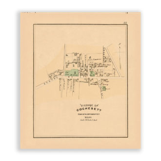
Cochesett Village, West Bridgewater, Massachusetts Antique Map Reproduction
$32.00 Add to cart -
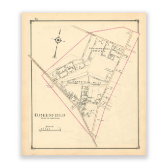
Greenfield, Nassau County Long Island, Antique Map Reproduction – Plate 51
$32.00 Add to cart -
Lake Wentworth, New Hampshir Antique Nautical Chart Reproductional
$32.00 Add to cart -
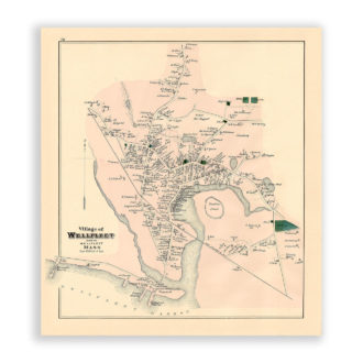
Wellfleet Village, Massachusetts Antique Map Reproduction
$32.00 Add to cart