


sku: 8320
Chesapeake Bay – Northern Part Antique Blueprint Nautical Chart Reproduction
$32.00
1937 Old Nautical Chart Blueprint of Chesapeake Bay – Northern Part
Framing Information
Framed Maps include UV filtering conservation glass, Drymounting, Sealed with brown paper, wired and ready to hang upon delivery.
Print Information
Maps are printed on heavy fine matte fine art paper with archival inks. Prints are trimmed to the listed size.
Related products
-
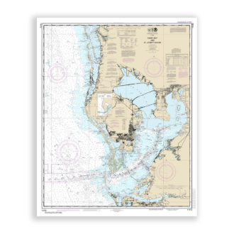
Tampa Bay, Florida Nautical Chart Reproduction
$32.00 Add to cart -
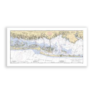
Fire Island, Long Island, New York Nautical Chart Reproduction
$32.00 Add to cart -
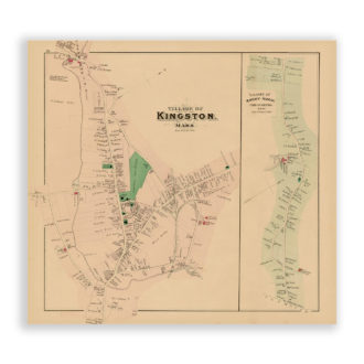
Kingston and Rocky Nook, Massachusetts Antique Map ReproductionMassachusetts Antique Map Reproduction
$32.00 Add to cart -
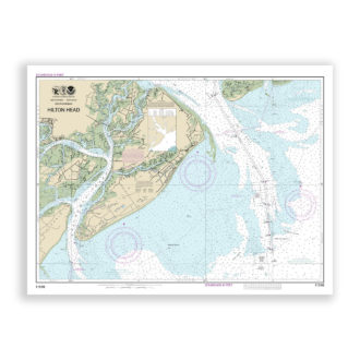
Hilton Head, South Carolina Nautical Chart Reproduction
$32.00 Add to cart