


sku: 005-wc70
Athol Depot, Massachusetts Antique Map Reproduction
$32.00
Originally Published in the Atlas of Worcester County, MA by F.W. Beers and Co. in 1870
Framing Information
Framed Maps include UV filtering conservation glass, Drymounting, Sealed with brown paper, wired and ready to hang upon delivery.
Print Information
Maps are printed on heavy fine matte fine art paper with archival inks. Prints are trimmed to the listed size.
Related products
-
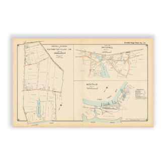
Southampton Village – Watermill – Montauk, Long Island, NY Antique Map Reproduction
$32.00 Add to cart -
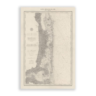
Long Beach Island, New Jersey Antique Nautical Chart Reproduction
$32.00 Add to cart -
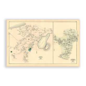
Dennis and Dennisport Villages, Massachusetts Antique Map Reproduction
$32.00 Add to cart -
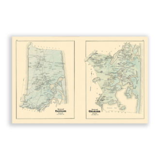
Towns of Eastham and Orleans, Massachusetts Antique Map Reproduction
$32.00 Add to cart