


sku: 1373
Connecticut River Nautical Chart Reproduction
$32.00
2010 Nautical Chart of Connecticut River
Framing Information
Framed Maps include UV filtering conservation glass, Drymounting, Sealed with brown paper, wired and ready to hang upon delivery.
Print Information
Maps are printed on heavy fine matte fine art paper with archival inks. Prints are trimmed to the listed size.
Related products
-
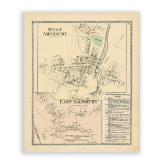
West Amesbury and East Salisbury, Massachusetts Antique Map Reproduction
$32.00 Add to cart -
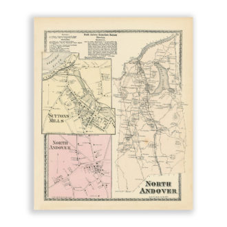
North Andover, Massachusetts Antique Map Reproduction
$32.00 Add to cart -
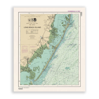
Long Beach Island, New Jersey Nautical Chart Reproduction
$32.00 Add to cart -
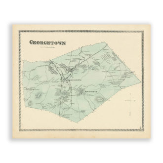
Georgetown, Massachusetts Antique Map Reproduction
$32.00 Add to cart