


sku: 2422
St John, Virgin Islands Antique Nautical Chart Reproductional
$32.00
1948 Old Nautical Chart of St John, Virgin Islands
Framing Information
Framed Maps include UV filtering conservation glass, Drymounting, Sealed with brown paper, wired and ready to hang upon delivery.
Print Information
Maps are printed on heavy fine matte fine art paper with archival inks. Prints are trimmed to the listed size.
Related products
-
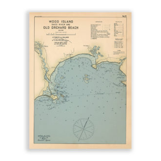
Old Orchard Beach and Wood Island, Maine Antique Nautical Chart Reproductional
$32.00 Add to cart -
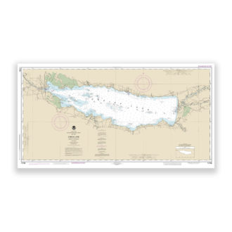
Oneida Lake, New York Nautical Chart Reproduction
$32.00 Add to cart -
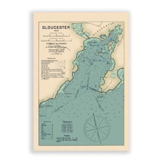
Gloucester Harbor, Massachusetts Antique Nautical Chart Reproductional
$32.00 Add to cart -
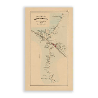
West Hanover, Massachusetts Antique Map Reproduction
$32.00 Add to cart